With the advancement of technology, it is now possible to accurately monitor the health of forests and track their disturbances, which has become more crucial than ever before. The cost of lost ecosystem services and management in forests has reached billions of dollars, making the collection of accurate data essential. By consistently using updated technology, we can gather data with precision and gain a better understanding of forests and their inhabitants.
With Drone Vision Aerial’s cutting-edge technology, we efficiently and safely provide aerial forestry and woodland services using LiDAR, Thermal (infrared), and RGB photos. Our advanced technology allows us to create high-quality outputs quickly and accurately, reducing data collection time from weeks to just a few days, even in challenging areas. This leads to a better understanding of the health of forests and their inhabitants, resulting in cost savings and improved ecosystem management.
We can provide you with comprehensive data and visualization of your woodland, whether you’re looking for a detailed 3D model or comprehensive statistics about the area. Our cutting-edge technology enables us to deliver results quickly and accurately.
Once the LiDAR data has been collected, we categorize all the elements into distinct classes, such as trees, low vegetation, cars, buildings, etc., so that we can isolate and analyze each feature to generate detailed models and reports.
Detailed Reports
We provide reports such as:
→ Tree and vegetation health → Tree count → Tree and vegetation height → Vegetation canopy coverage → 3D “Virtual Twin” mapping → LiDAR topographic mapping → Drainage patterns and flood-prone areas → Ungulate monitoring → Catastrophe damage assessment
Water drainage and flood-prone areas
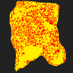
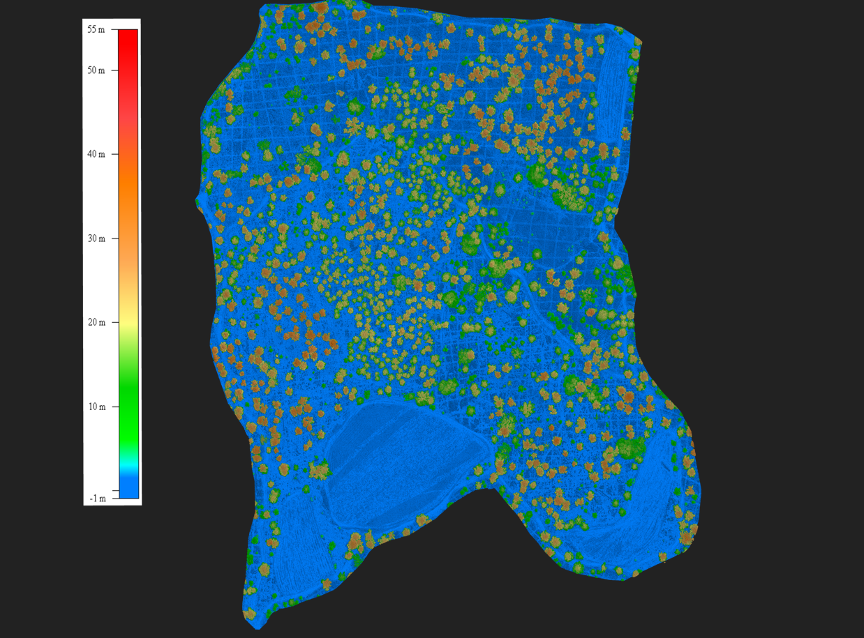
Tree Height
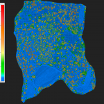
Plant Health
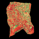
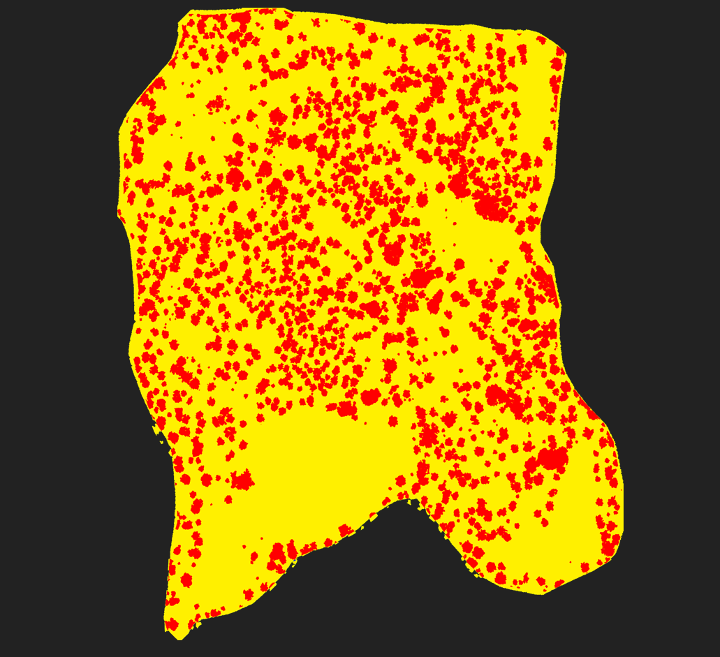
Vegetation Canopy
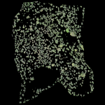
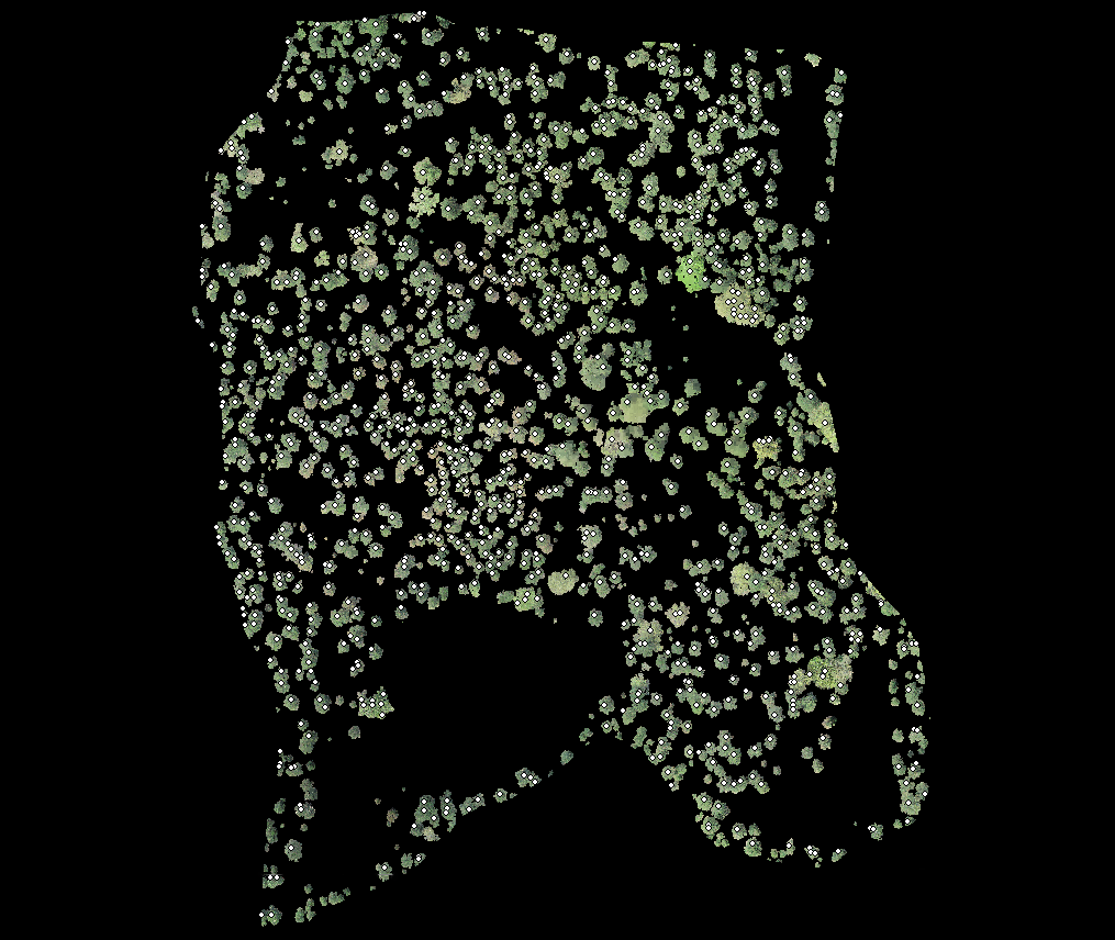
Tree Count
Some of the most useful reports include information on the height of trees, the health of vegetation, the density of tree canopies, and the total number of trees in an area.
Digital Terrain Model with contour lines
Ungulate monitoring using thermal imagery
This website uses cookies to improve your experience. By using this website you agree to our Data Protection Policy.


![HDR created and tone mapped with easyHDR 3.12.2: [1] DJI_0855.DNG, [2] DJI_0853.DNG, [3] DJI_0852.DNG, [4] DJI_0854.DNG, [5] DJI_0856.DNG](https://dronevisionaerial.com/wp-content/uploads/2021/10/Twilight-2-scaled.jpg)